| Name | Last modified | Size | Description | |
|---|---|---|---|---|
| Parent Directory | - | |||
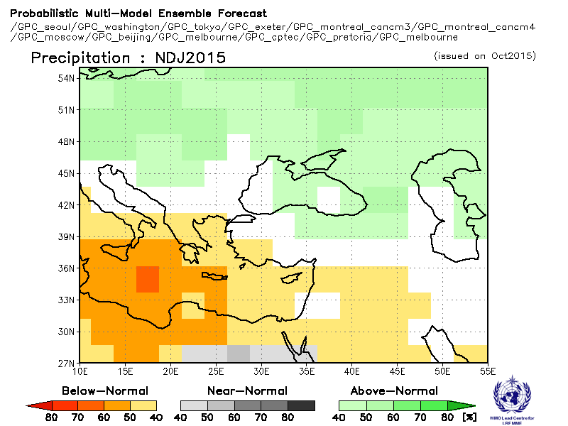
| WMO-LC-LRF-SEECOF-NDJ-Precip-Composite-PMME-01102015.gif | 21-Oct-2015 07:41 | 24K | ||
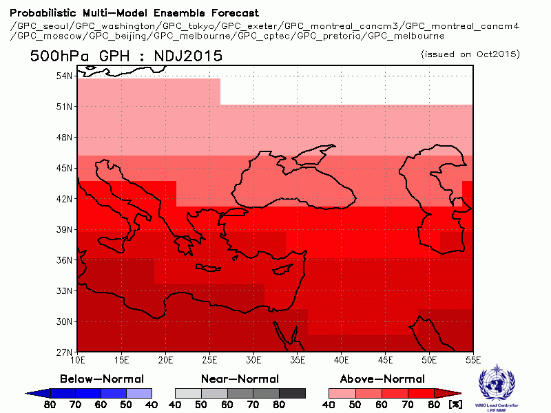
| WMO-LC-LRF-SEECOF-NDJ-500-GPH-Composite-PMME-01102015.gif | 21-Oct-2015 07:43 | 23K | ||
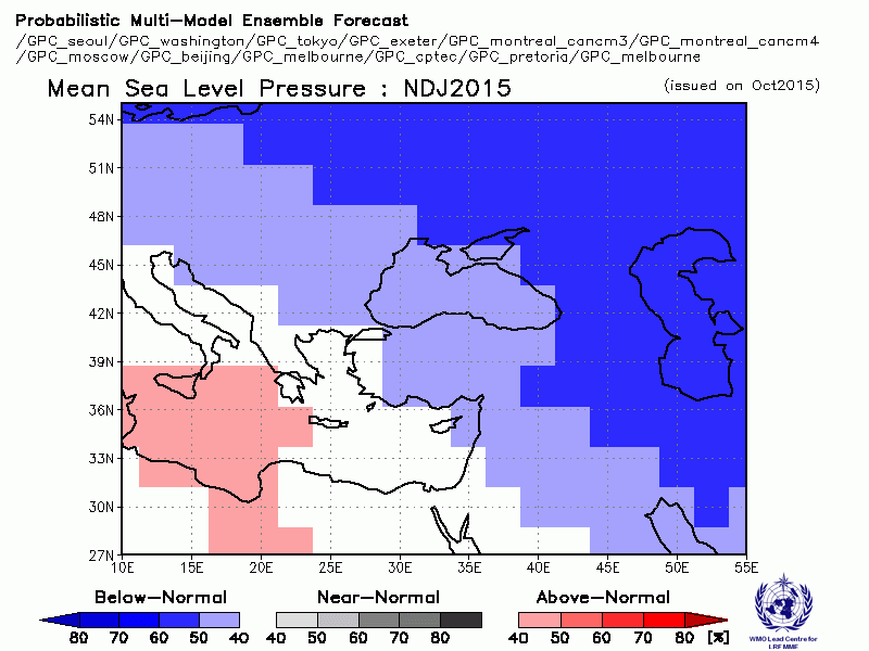
| WMO-LC-LRF-SEECOF-NDJ-MSLP-Composite-PMME-01102015.gif | 21-Oct-2015 07:44 | 23K | ||
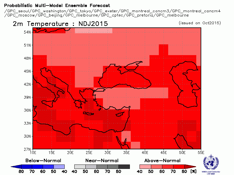
| WMO-LC-LRF-SEECOF-NDJ-T2m-Composite-PMME-01102015.gif | 21-Oct-2015 07:44 | 25K | ||
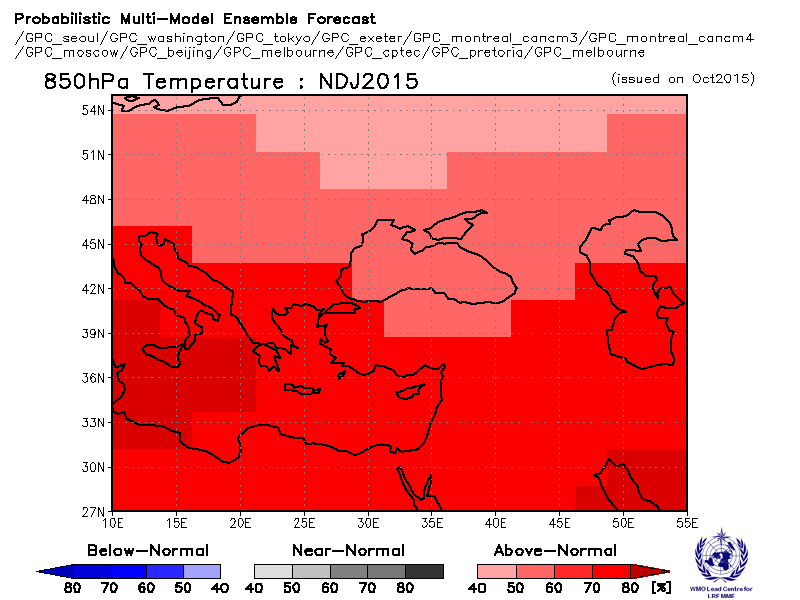
| WMO-LC-LRF-SEECOF-NDJ-T850-HPA-Composite-PMME-01102015.gif | 21-Oct-2015 07:45 | 22K | ||
| WMO-LC-LRF-SEECOF-NDJ-T2m-Below-Normal-PMME-01102015.gif | 21-Oct-2015 07:46 | 18K | ||
| WMO-LC-LRF-SEECOF-NDJ-T2m-Near-Normal-PMME-01102015.gif | 21-Oct-2015 07:46 | 18K | ||
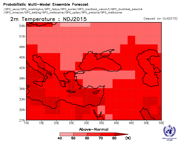
| WMO-LC-LRF-SEECOF-NDJ-T2m-Above-Normal-PMME-01102015.gif | 21-Oct-2015 07:47 | 21K | ||
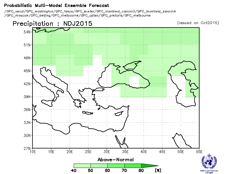
| WMO-LC-LRF-SEECOF-NDJ-Precip-Above-Normal-PMME-01102015.gif | 21-Oct-2015 07:47 | 20K | ||
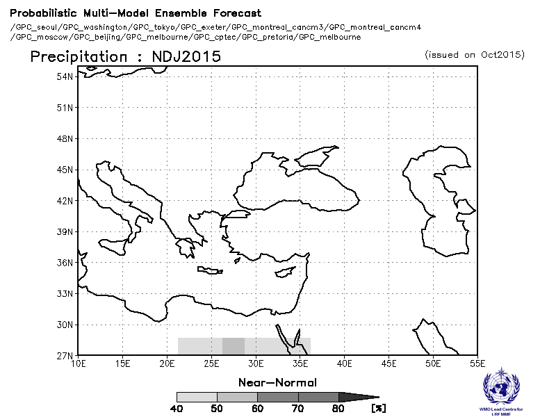
| WMO-LC-LRF-SEECOF-NDJ-Precip-Near-Norma-PMMEl-01102015.gif | 21-Oct-2015 07:48 | 19K | ||
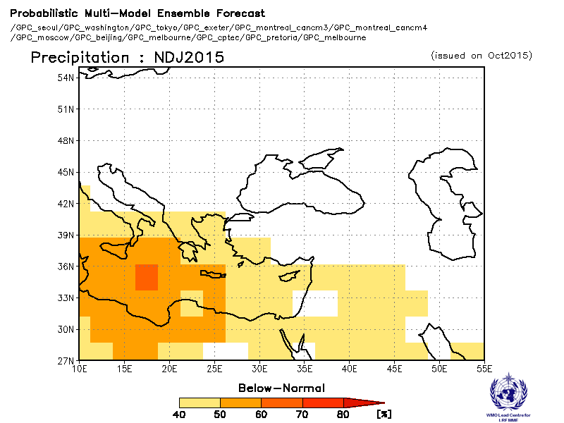
| WMO-LC-LRF-SEECOF-NDJ-Precip-Below-Normal-PMME-01102015.gif | 21-Oct-2015 07:49 | 20K | ||